Agriculture Mapping
precision agriculture, the farmer needs aqurate data and info about the field/land. primary information is genrated from testing of and yield data to manage the exact amounts of fertilizer or seeds to put. Using exact amounts increases yield and minimize waste, thereby improve return on time and money. Synthetic maps of agricultural zone make up a very High-level of agricultural maps. They help farmers to increas production, reduce costs, and manage their land resources more efficiently.
Precision Agriculture Mapping
Remote Sensing in agriculture plays a important role to monitor and manage the soil and irrigation system of farm. Precision Agriculture Mapping is as an essential tools for management of agricultural sector by collecting and achieveing the accurate data into a mapping model. Remote Sensing in agriculture also helps to manage and taking control of agricultural resources.
We use various Geospatial, spectral and temporal resolutions for:
- Yield Estimation.
- Crop Assessment and Crop health
- Irrigated landscape mapping
- Soil and irrigation analysis
- Suitability studies
- Soil Erosion identification and remediation
- Mapping for vegetation cover and monitoring
- Change detection
- Land degradation studies
- Elevation models for drainage
Agriculture Mapping Samples
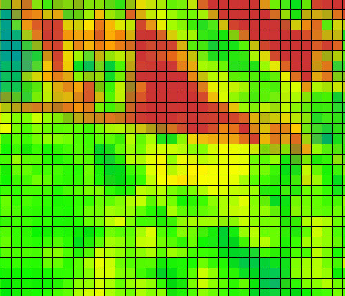
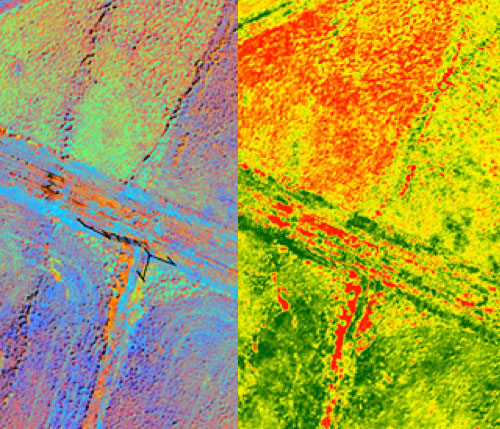
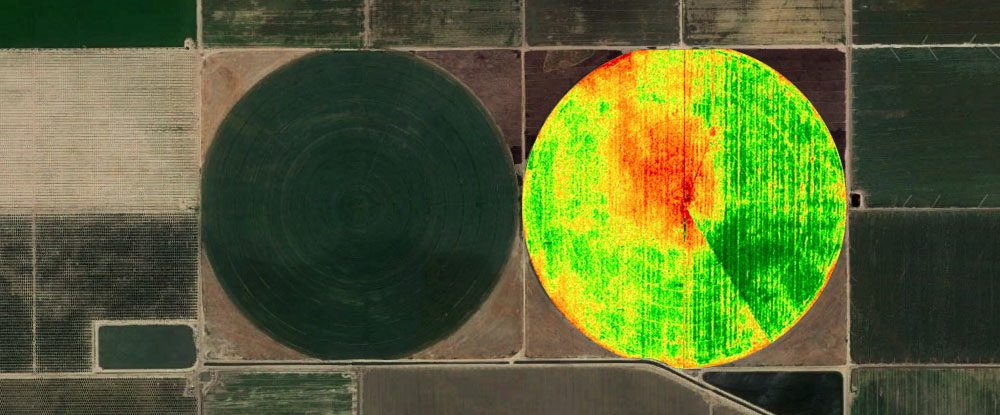
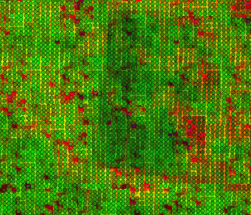
NDVI

Soil Mapping
Tree Grading
Normalized Difference Vegetation Index (NDVI)
The farming, forestry and golf Sector are using the standard NDVI index analysis for many years but with the ease of availability of hyperspectral and high-resolution Satellite and drone images, utilizing an wisw Multispectral range, Cartosolution can work with a variety of vegetation indices to fetch the band combinations for farming, soil and golf analysis to support end user.
- OSAVI - Optimized soil-adjusted vegetation index
- REDVI - Red-edge difference vegetation index
- REIP - Red-edge inflation point
- RERDVI - Red-edge renormalized difference vegetation index
- RERVI - Red-edge ration vegetation index
- RESAVI - Red-edge soil-adjusted vegetation index
- RVI - Ration vegetation index
- SAVI - Soil-adjusted vegetation index
- TCARI - Transformed chlorophyll absorption reflection index
- WVVI - WorldView Improved Vegetation Index
- CCCI - Canopy chlorophyll content index
- OMNBR - Optimal multiple narrow band reflectance index
- CIRedEdge - Red-edge chlorophyll index
- CWSI - Crop water stress index
- GNDVI - Green normalized difference vegetative index
- LAI - Leaf area index
- MRESAVI - Modified RESAVI
- NDRE - Normalized difference red edge
- NDVI - Normalized difference vegetative index
- NNI - Nitrogen nutrition index

Drone mapping for digital agriculture
Farmers face numerous challenges with yields, capital inputs and changing climates. Whether your client managing many large farms or one small estate, having the right technology can make things manageable. We work with you to process and analyze data that makes your descision more precise. We keep working to benefit you by bringing the latest advancements in drone technology and crop research into our solutions. More...